Airport surveys and mapping

© Zesmill B.V.
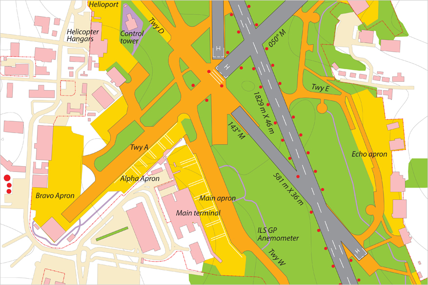
Zesmill carries out airport area surveys that meet appropriative completeness and accuracy requirements for ICAO resolutions and many national standards. ICAO’s requirements for terrain and obstacle survey, eTOD database structure, metadata and data quality are stated in ICAO Annex 15. At the same time, eTOD data sets along with actualized 2D and 3D maps are provide airports, airlines and air-traffic authorities with up-to-date, accurate and complete information.
The first step in airport area mapping is obtaining the high-resolution aerial imagery and Digital Elevation Models (DEM). Zesmill uses up-to-date aerial imaging, LIDAR and photogrammetric technologies to obtain very high-resolution images, orthorectified images, DTMs and DEMs. We also use satellite data (satellite images, SAR data) as an additional source of information. Further steps include image interpretation, ground survey, and obstacle identification and inventory. Ground surveys are conducted to obtain precise parameters of selected obstacles and to ensure the data meets the appropriate completeness and accuracy.
Zesmill also provide the following surveying and mapping services:
- highly accurate airport and heliport positioning surveys based on ICAO WGS-84 guidelines
- airport environs mapping and 3D modeling
- DTM, DEM generation using digital photogrammetric and LIDAR technologies, obstacle surveys, ETOD data sets development
- terrestrial laser scanning (TLS) and precise leveling of airport runways, taxiways and aprons, all delivered in accordance with the ICAO and national standards
- engineering surveys for airport master planning, improvement and redevelopment
Airport pavement maintenance is necessary for any airport and must be carried out on a regular basis. Our surveying instruments like imaging GPS-rovers, survey-grade GNSS/GPS-receivers and total stations and digital levels also can be used for airport pavement condition assessment and surveys. Trimble V10 imaging rover technology with the integrated camera system precisely captures 360-degree digital panoramas for visual documentation of airport pavements.
All images, digital elevation models, surveyed runways, taxiways, airport facilities as well as airport environs (including obstacles), roads and utilities can be integrated into airport GIS to be used by different airport divisions. Centralized collection and storage of geospatial data is the precondition for efficient and comprehensive data use.
Zesmill serves airports, heliports, airstrips as well as airport development companies primarily in Central and Eastern Europe, Asia, and Caucasus.


